
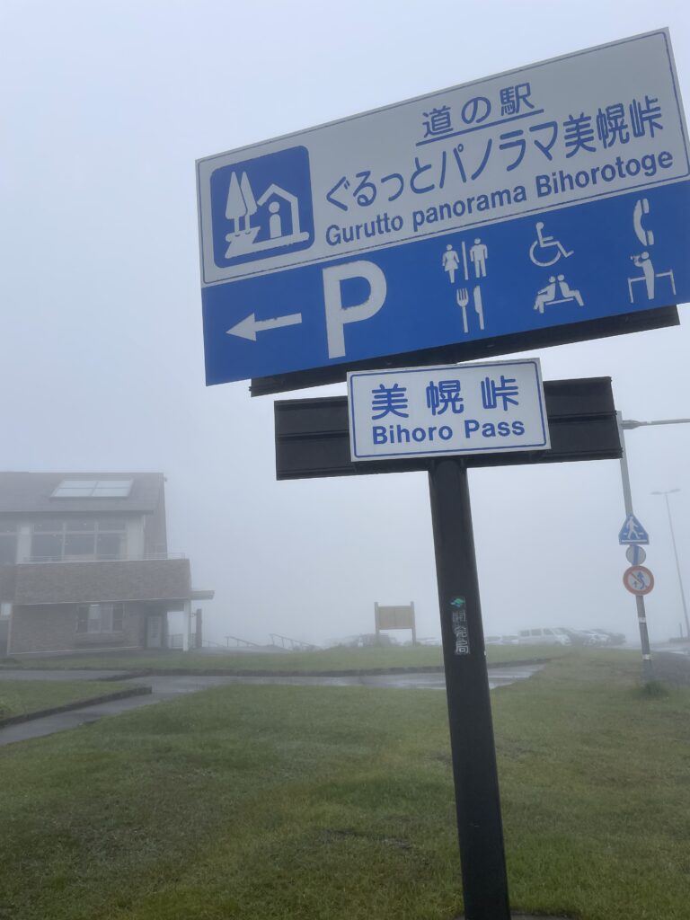
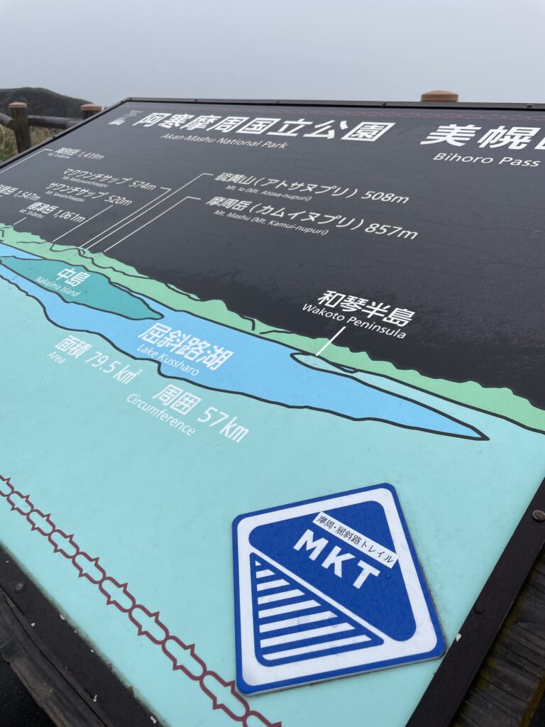
The car was parked at the Bihoro Pass road station.
Half a day had opened up. Looking at the map, I started thinking about a section of the Mashu Kussharo Trail (MKT) — Section 3. I’d already walked from Tsubetsu Pass to Wakoto Peninsula the previous year, so the plan this time was to skip that stretch and connect what remained: from near the Kussharo Prince Hotel up to Bihoro Pass, combining a bicycle approach with hiking. Purists might call this cheating. But I think a style like this — using a bike to link a section hike — could open these trails up to more people.
Route Overview
Start / Finish: Bihoro Pass Michi-no-Eki (Kurutto Panorama Bihoro Pass)
| Segment | Method | Description |
|---|---|---|
| Bihoro Pass → near Kussharo Prince Hotel | Bicycle | Descend Route 243 toward Teshikaga |
| Prince Hotel → stream crossings → Bihoro Pass Old Road junction | Hiking | MKT Section 3 — Forest Route |
| Old Road junction → Bihoro Pass Observation Deck → Road Station | Hiking | Climb back via the old road |
| Bicycle retrieval | Car | Picked up after finishing |
Bicycle Segment: Down from Bihoro Pass
Fog. Cloud all the way down.
Setting off from the Scenic Byway signpost on Route 243, we descended by bike. From the pass at 525m down to the shore of Lake Kussharo — a dozen-odd kilometers of downhill. The legs stayed rested. The elevation took care of itself.
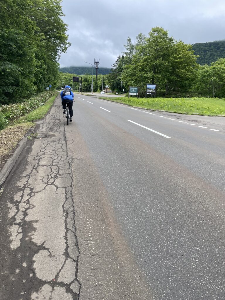
Near the Kussharo Prince Hotel, we confirmed the trail entrance and left the bikes there.
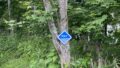
Hiking Segment ①: Into the Forest

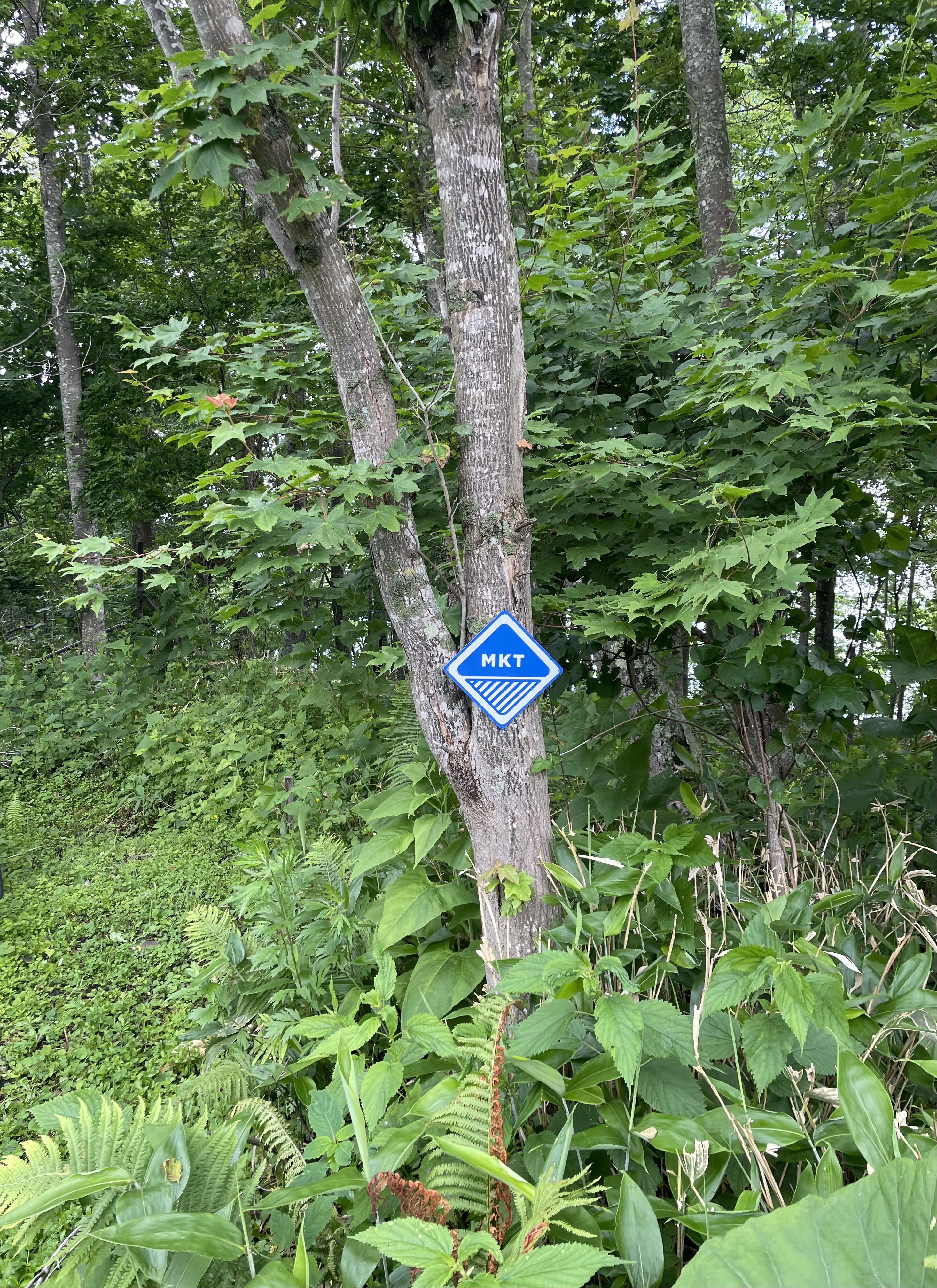
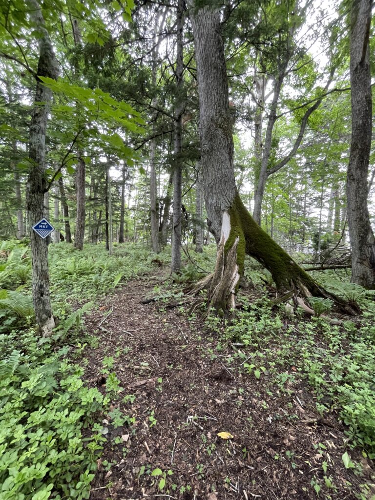
An MKT marker was fixed to a tree. Blue diamond shape. That’s the way in.
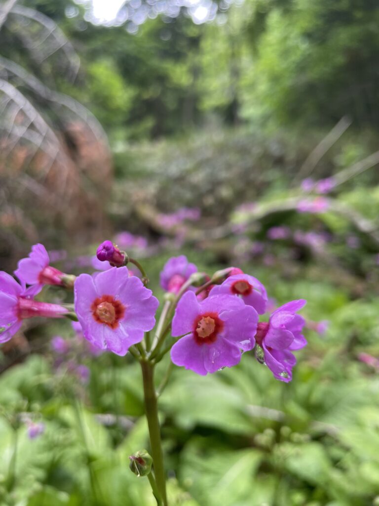
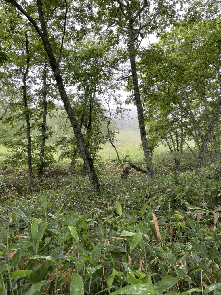
The path was clear for a while. Broadleaf forest, damp underfoot. The low plants — ferns and what I think was primrose, though I’m no botanist — lined the trail. Stream crossings appeared repeatedly. Step on a stone, jump, or just walk through — each one a small decision.
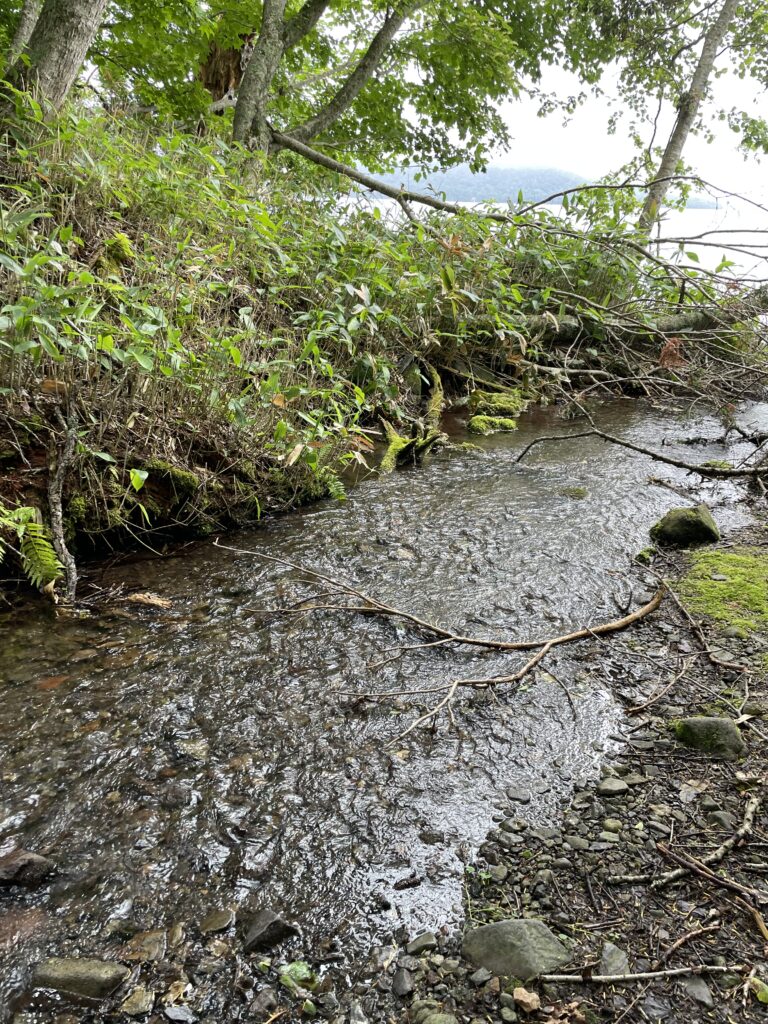
Fallen trees were everywhere. Old ones, fully consumed by moss, had become part of the landscape. New ones blocked the path.
Duck under, step over, find a way around. This wasn’t a manicured mountain trail. It asked you to read and move. That was the interesting part.
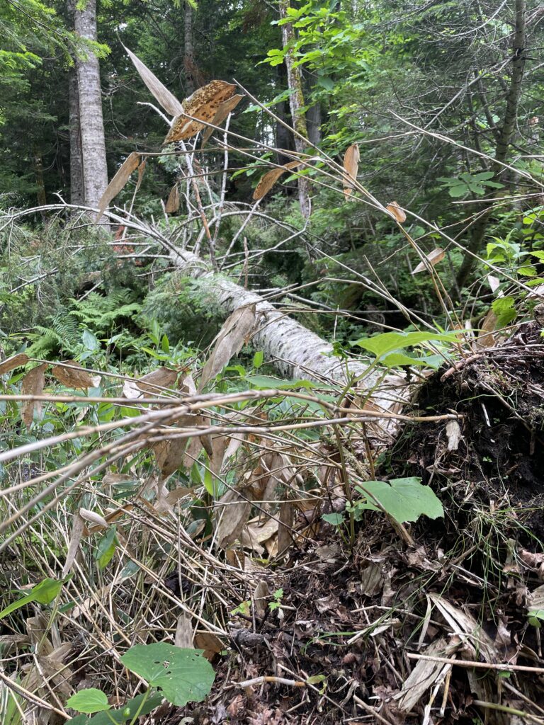
(I kept thinking of the Kushiro River headwaters — where fallen logs are also left with minimal intervention. Something consistent in the way these places are managed.)
Through a gap in the trees, Lake Kussharo appeared. Fog sitting low on the water.
Hiking Segment ②: The Bihoro Pass Old Road
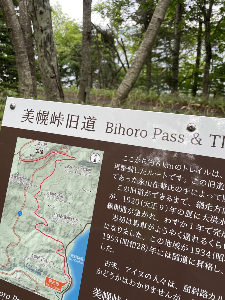
Following the lake shore trail brought us to the junction of the Bihoro Pass Old Road.
A sign here explains: this route was opened in 1920 (Taisho 9). Until National Route 243 took its current alignment, this was an active road connecting the Teshikaga area with Kushiro and Abashiri. Horse-drawn vehicles used it. You can still feel the road’s width and geometry in the gradient — the shape of something built for more than feet.
The climb back was gentle. Widepath, easy grade.
The current Route 243 passes close by, but this old road is genuinely wild. We whistled periodically and moved with awareness. That feeling — of being a guest in someone else’s habitat — wasn’t manufactured. The trail produced it naturally.
At the Bihoro Pass Observation Deck, the fog had thinned a little. The western half of the Kussharo Caldera and the lake came into view.
We continued to the road station, confirmed the connection point with the KCT (Kussharo Caldera Trail) / Hokkaido East Trail, and turned back.
One thing worth noting: the timing works well for lunch. Start in the morning, arrive at the pass around midday, eat at the road station restaurant. Spending money where you walk is one small way of supporting what keeps these places going.
On This Style of Travel
The approach here: bicycle in, hike the trail, retrieve the bike by car.
The difference from standard hiking: you use the elevation drop by bike, which shortens the walking time without removing the experience. You get two things in a single day — the speed of descending on two wheels, and the depth of moving through forest on foot.
MKT Section 3 is long. Walking it all in a day takes time and energy. A bicycle makes the core section accessible in half a day. That’s worth something.
The Wakoto Peninsula section is still unwalked. Next time.
Reference
MKT (Mashu Kussharo Trail) A long trail connecting the Mashu and Kussharo lake areas. Three sections: Section 1 (Volcanic Route), Section 2 (Lake Route), Section 3 (Forest Route). Maintained and operated by the Teshikaga Trail Club.
→ MKT Official Site (Teshikaga Trail Club)
KCT (Kussharo Caldera Trail) Connects Tsubetsu Pass, Bihoro Pass, and Mt. Mokoto along the Kussharo Caldera rim. Connects with MKT at Bihoro Pass.
HET (Hokkaido East Trail) Long trail from Kushiro to Rausu. Passes through KCT and MKT routes along the way.
コメント